Can you imagine, if there could be a port town existed nearly 4400 years ago?
Yes, it did exist.
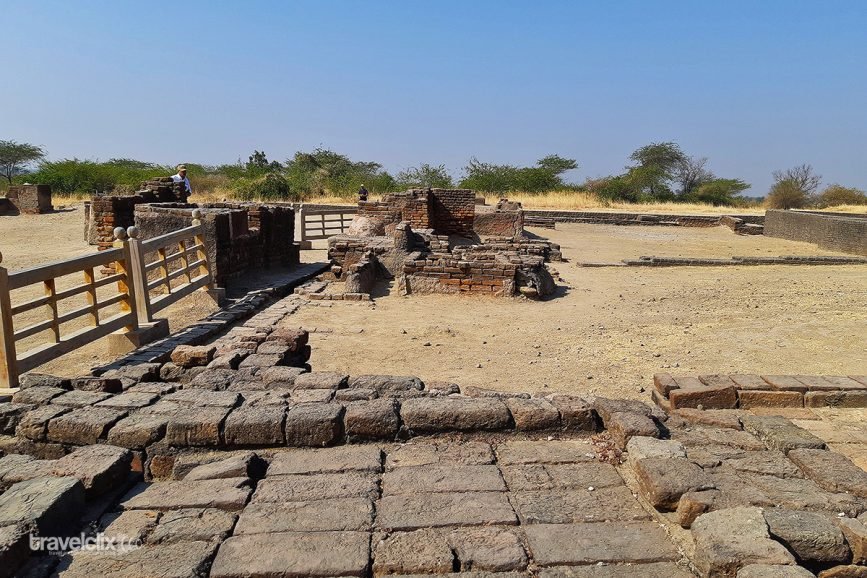
Lothal – A well planned Harappan Port town in the history of India
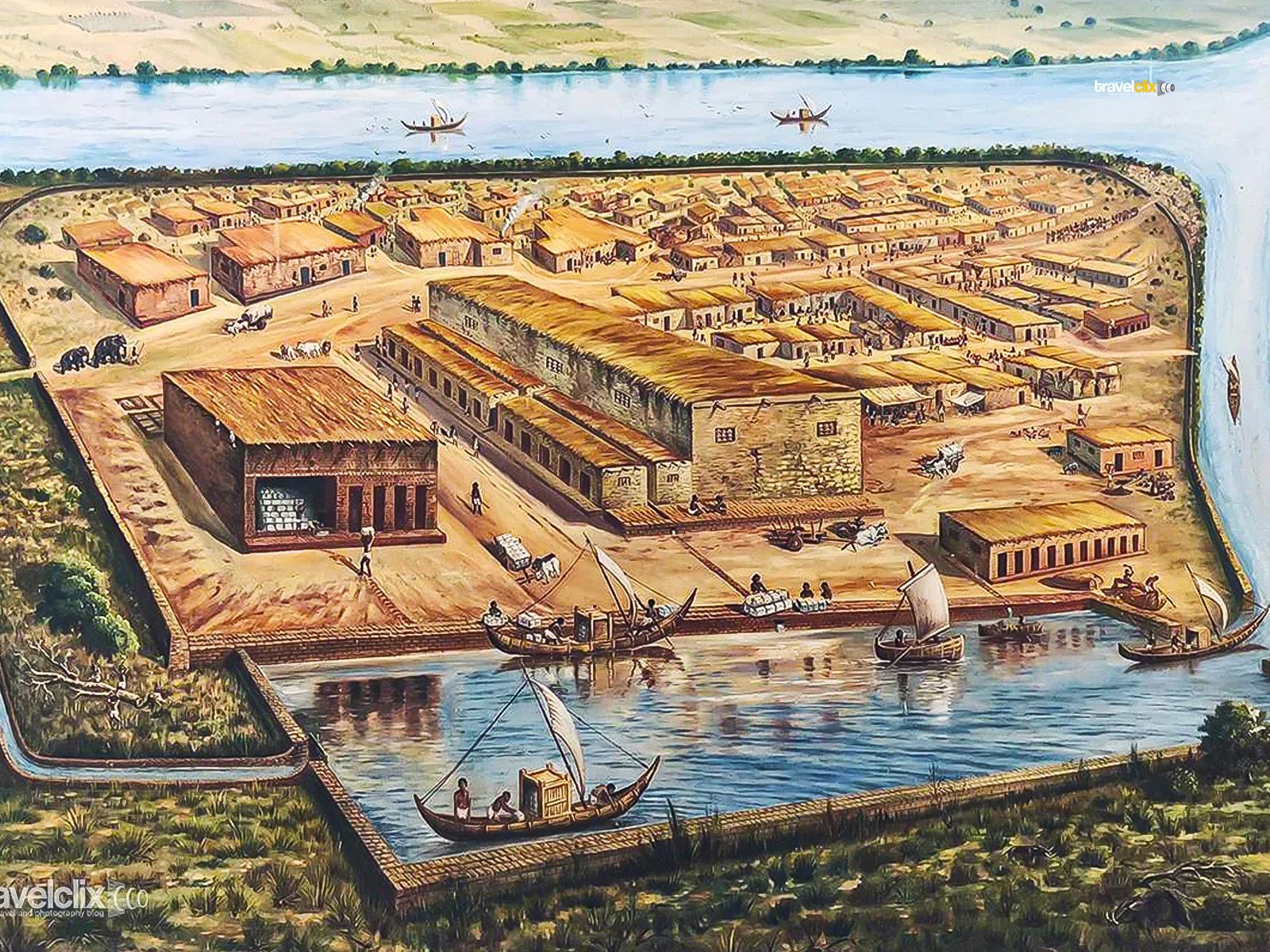
consisting of a large “Dock, wharf and Warehouse” built with burnt bricks. Evidences at Lothal provide existance of Harappa culture between 2450 BCE to 1600 BCE
We’re going to learn about one of the port cities from renowned Indus Valley Civilization. Lothal is situated in Dholka Taluka, Ahmedabad district of Gujarat State in India. Lothal town was constructed near the Gulf of Khambhat and along the Bhogava River which is a tributory of Sabarmati River. Lothal in gujarati dialect formed by combining two words i.e. Loth and thal means ‘The Mound of The Dead’. Mohenjo-daro in Sindhi language expresses the same meaning.
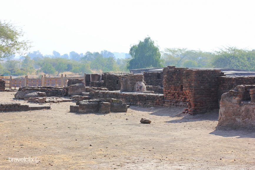
The town in ancient times was thought to be much larger in extent as compared to what it appears today. The shrinking of the place can be attributed to the time-to-time silting and erosion during last 3000 years. The findings of structural remains and painted pottery at 1000ft of mound in the south direction, suggest the extension of township was actually much beyond its current boundaries.
Archaeologist Dr S. R. Rao Mentions:
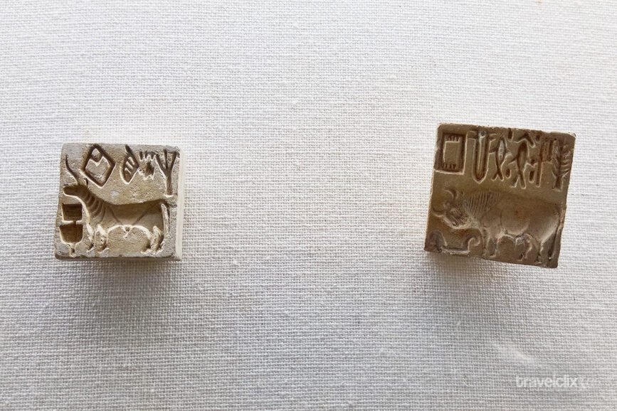
A memorable day in the annals of the excavation at Lothal was the one on which as many as fifty terracotta sealings were found within two hours in a small area of 3ft square in one corner of what was then called a ‘kiln’.
It established that Indus seals were used in export-import trade for sealing cargo. The occurrence of so many sealing also proved that Lothal was an important commercial center.
The Driving Force
The prime intention of Lothal excavation was to confirm its association with Harrapan Civilization. Whether it’s a true Harrapan Settlement where its inhabitants observed the same urban discipline. Who also enjoyed the material prosperity as those in the metropolitan centres of Harappa and Mohenjodaro. This object was soon achieved in the first season of excavation for the findings of the typical Indus weights, seals and painted pottery. The well-thought town planning and the excellent sanitary systems existed at Lothal have successfully wiped out the doubts of it being the true Harappan Town.
Town Planning at Lothal
Harappans must have trade contacts with Lothal before their settlement in this area. It looks like the arrival of Harappans and then their respective settlements in Lothal must have been steady and peaceful. There is no evidence of violence or any sudden inrush of newcomers.
Slowly and in a friendly manner they introduced their ceramic wares, lithic tools, and other types of equipment. The locals must have happily accepted their superior tools and adopted new standards of weights and measures for their respective advantages. The town planning must have been initiated with blue-print, planning, and then execution with utmost perfection only after the “flood” devastated their village. Well-thought planning was imperative to protect the village from such floods or devastation in the future.
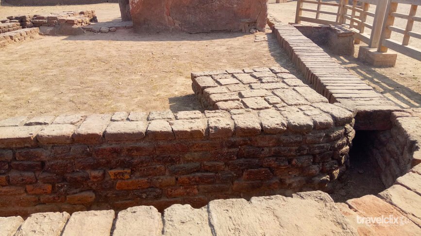
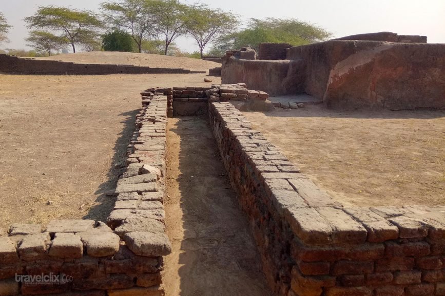
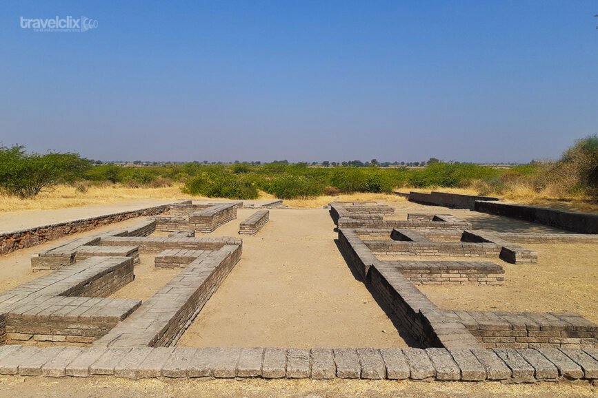
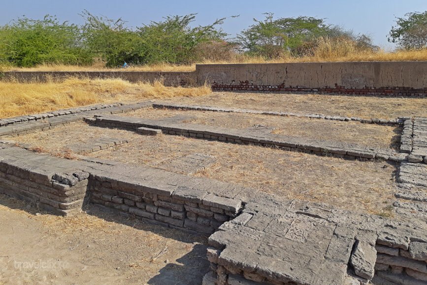
The planning consisted of improving the way of living by introducing public drains, wells, and separation of the industrial area from the residential one. They laid out platforms and streets for smooth traffic within. The streets were from broad to broadest i.e. from 12 ft. wide to 40 ft. wide allowing ample space for movement. On either side of the streets or lanes were houses built on 4 to 12 ft. high platform in a straight row. Under these streets ran an efficient drainage system which was sophisticated in some respects to that of Mohenjo-daro. The drainage system of Lothal was highly efficient consisting of underground drains, water-chutes, soakage jars and cess-pools to drain off sullage and stormwater.
The construction of Dock, Warehouse, and Wharf to allow trade-related activities indicates the careful planning and successful execution with precision.
The entire town was secured by building an outermost wall of mud-bricks and mud. This wall acted as a protection against floods. The industrial area e.g. bead factory and smithy were separated from residential areas while the cemetery was purposely kept out of the town and near the water source.
Provision of bath in all houses at Lothal–be it acropolis or lower town–indicates that Harappans had developed a high sense of sanitation. However, Acropolis was served with the best baths and drains than those when compared with all other sectors.
The Harappans “Uniformity” was the distinct feature of their civilization. Throughout the vast territory of cities and towns, that came under the influence of the Harappan civilization clearly show the “Uniformity” in the products of the Harappan craftsmen and artists.
Dock at Lothal
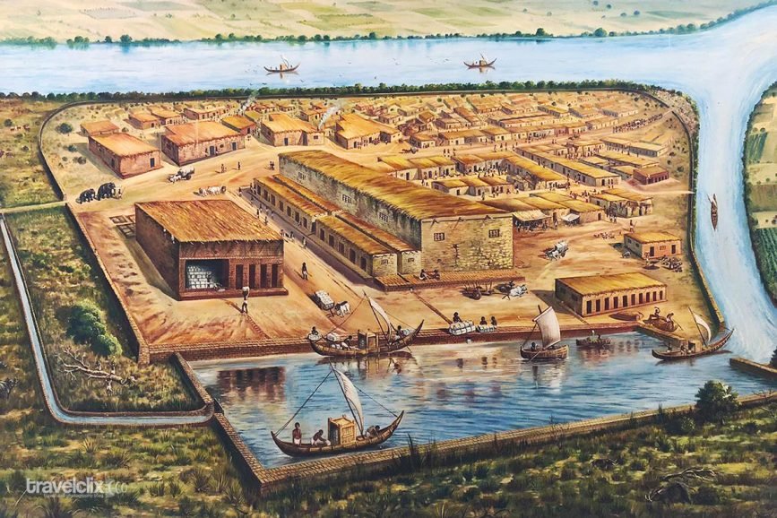
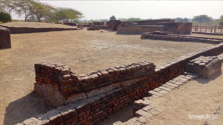
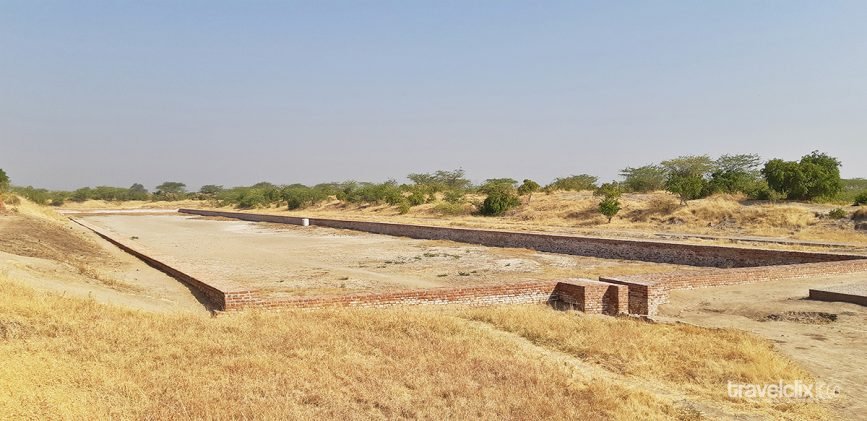
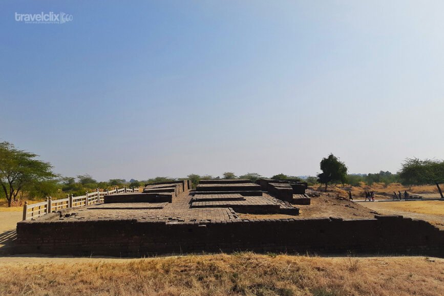
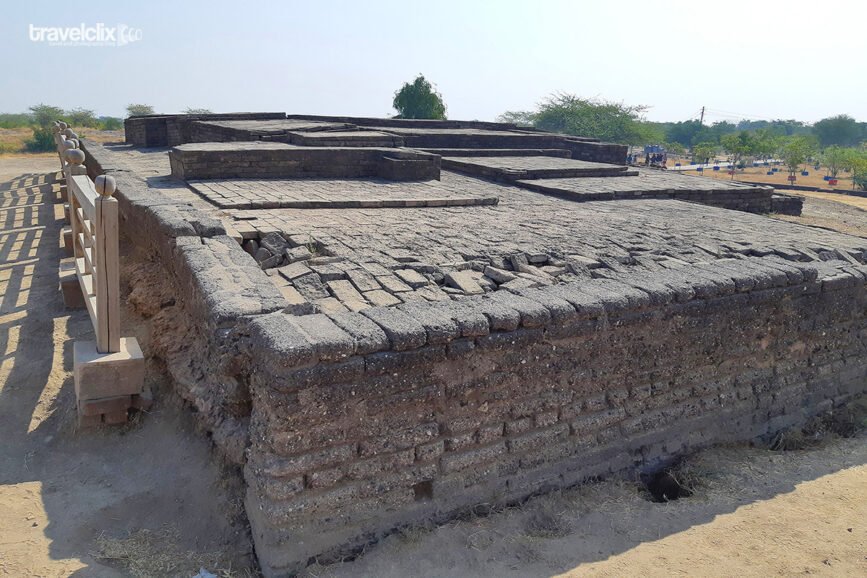
As they began excavating the mounds, they initially noticed a wall structure of kiln-burnt bricks. In order to find out more about the structure they kept excavating and clearing the area carefully. Once the entire area had been cleared, it turned out to be the largest wall of a trapezoid basin. Such a large structure ever built by Harappans measuring on an average 711 ft. from North to South and 120 ft. from East to West.
The purpose of this basin with massive walls and an inlet channel wasn’t clear in the beginning. The basin was then in the controversy about its actual purpose but the presence of stone anchors, marine shells, painted pottery of Sumerian origin and the occurrence of the Persian Gulf seal at Lothal put an end to this controversy. As they studied it more and Nullah on one side and spill-way on the other side found then it was confirmed as a Dock. The dock was built for allowing ships to enter and align with 800 ft. long platform for hauling of cargo.
The intelligence of the planners was recognized on the discovery of Nullah & a spill-way. The western margin of the dock allowed a river (which was flowing on the western margin) water to flow through this Nullah for the ships to enter. The spill-way with wooden door (used as a water-locking system during high tide & low water) took care of maintaining the required water level for flotation of boats and ensured safe haulage of cargo thereafter.
Lothal Warehouse
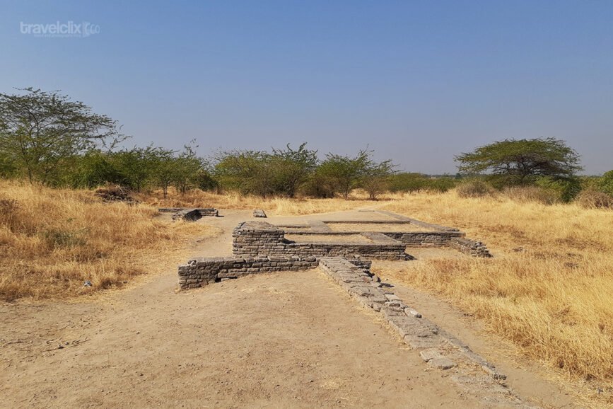
Near the dock was a large structure built on a massive podium. This structure is a series of cubical blocks built with mud-bricks which initially was hard to determine for its usage. Later on it was confirmed as a “Warehouse” that used to serve the purpose of examining & storing the cargo hauled from the ships. The wharf alongside the dock to examine and seal the cargo was built next to the warehouse.
Import, Export and Manufacturing at Lothal
Manufacturing industries like bead making, ivory, shell working, and bronze-smithy held high importance in Lothal. They had established trade-relations with “Mesopotamian” cities through Bahrain islands. Copper and Tin were imported from outside. These probably have came from copper mines of “Oman” or from the “Persian” highlands through Susa and Bahrain. The trading with “Sumerian” cities was confirmed with seals, beads and other objects found in the Euphratis-Tigris valley. Gorilla and Mummy models made from terracotta with variety of African wood suggest the trade-relations with East Africa and Egypt. Lothal had large workshops engaging several craftsmen under the safe roof. Moreover, impressions of multiple seals on the “Sealings” suggest a partnership of some kind in the trading activities.
History of Lothal – Harappa Port Town
The Discovery of Harappan sites was a part of systematic of survey of Gujarat. It was undertaken by the Archeologist & Author Dr. S.N. Rao in 1954. The programme was to locate the Harappan settlements lies in the present borders of India. Rangpur was excavated during 1953 survey which had confirmed the extension of Harappan Civilization as far south as of Saurashtra. The presence of pots e.g. Buff Ware & Lustrous Red Ware of satisfactory explanation of Harappan Civilization. However the absence of typical “Indus Seals” had actually triggered the necessity of further investigation along the tributary of Sabarmati River in the search of Harappan Settlements.
Harappans must have preferred the areas for their permanent settlements, from the alluvial plains of Sabarmati to the hilly regions of upper reaches. With this thought in mind, they began to conduct a village-to-village survey starting from Dholka mound. This survey ended at low lying mounds such as Laxmipura. At Laxmipura, they found the pottery and similar other objects which confirmed that this mound particularly known as “Lothal” was a true Harappan Settlement.
Relative Books
You can refer following book for more information:
- Lothal A Harappan Port Town (1955-62) Volume 1 By Mr. S.R. Rao
- Lothal A Harappan Port Town (1955-62) Volume 2 By Mr. S.R. Rao
Note: We have used above two books/files to write information in this blog post.
 Vernal Hanging Parrot
 Pench - Introduction
 Pench - Safari In The Rain
 Lothal - Harappa Port Town
 Tadoba Diaries – An Unforgettable Day
 Khajuraho Group of Monuments